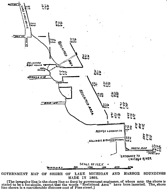
This diagram from 1892 shows the development of the land east of the natural shoreline. The city owned the open space at the end of Chicago Avenue and at the time of this rendering the space was still open between the two marked "reclaimed areas." Rather than filling in the ground at this time, the city was considering spanning a bridge across the open water and utilizing the inverted harbor as a landlocked dock for boats.
Within a few years, the Lincoln Park Commissioners were filling the land with dirt, ashes, and other garbage
like the landowners to their north and south.