In this Pre-History chapter of the Shifting Grounds project, I explore the area that will one day house today's Museum of Contemporary Art Chicago, a location with no land mass until after 1871. Chicago Avenue, included in the 1833 Kinzie Addition to Chicago, was established as the northern boundary of the Town of Chicago at its 1835 incorporation. The whole parcel of land, now known formally as Block 21 in the Lake Shore Drive Addition to Chicago, covers the ground between Chicago Avenue and Pearson Street from the point west of Michigan avenue where the Water Tower stands, all the way east to Lake Shore Drive. Block 21 has a distinguished place in Chicago's history, both for the landmark Water Tower and Pumping Station that survived the Great Chicago Fire of 1871, and for its location as the source of the young city's first fresh water. Also, the early nineteenth-century development of the surrounding affluent Streeterville neighborhood and then the mid-twentieth century addition of the John Hancock Center have maintained the region as an international tourist destination. The corner of Chicago Avenue and Michigan Avenue is said to be one of the busiest in the world. |
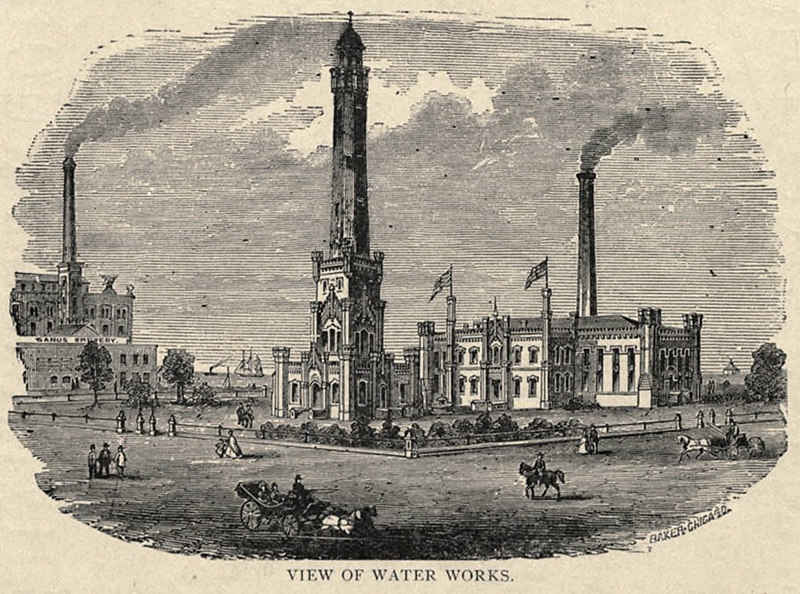 In this idealized rendering, published in the 1873 Stranger's Guide to Chicago, the pumping station and water tower form a fenced off and landscaped area. The view is from today's southwest corner of Michigan and Chicago Avenues and illustrates all of Block 21. The Sand's Brewery is pictured left, at the northeast corner of Pearson and Pine Streets, and the two-mile crib can be seen in the distant water to the right of the pumping station. Pine Street has been moved west to the other side of the tower, joining the water works into one parcel. |