|
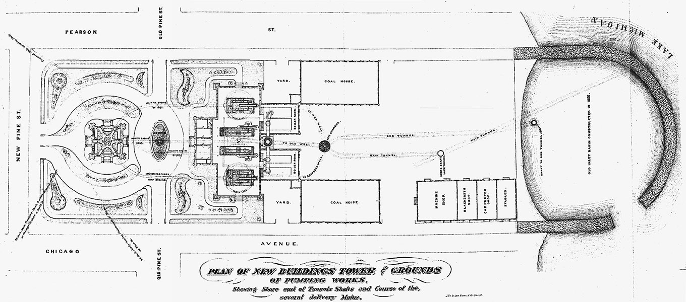
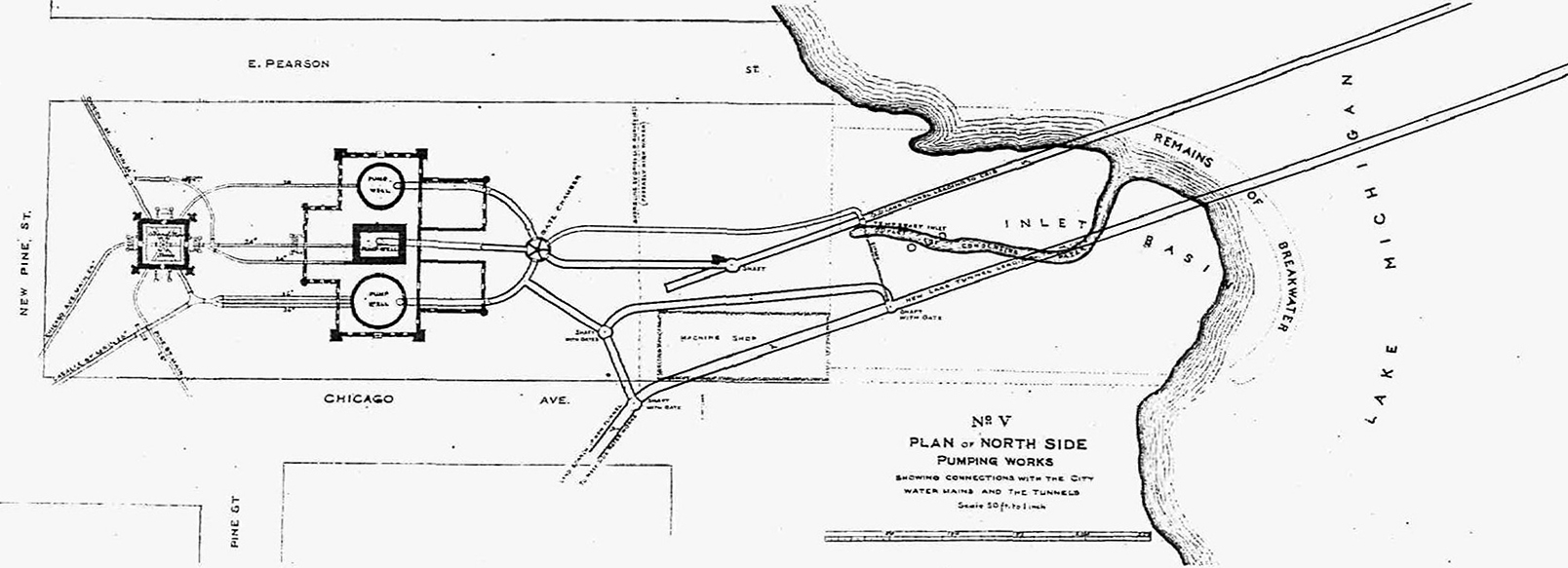 In addition to the original 5-foot tunnel leading from the 2-mile crib, this 1876 illustration of the tunnel network includes the second tunnel, 7-feet in diameter that fed water south into the city. The mound shape at the shoreline shows that land has filled in the old breakwater wall from the original 1853 Water Works. |
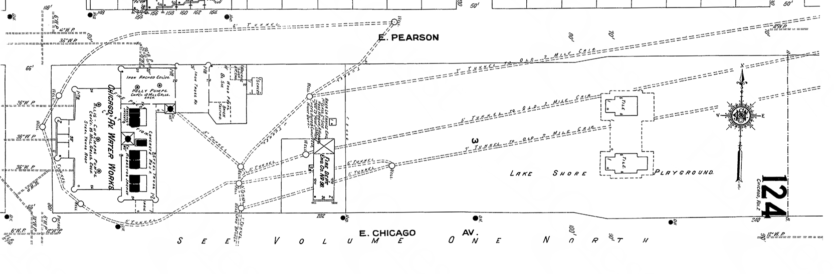 Sanborn Insurance Maps illustrate road details, building structures and materials, and waterlines. Sanborn Insurance Maps illustrate road details, building structures and materials, and waterlines. This 1906 Sanborn Insurance Map detail shows the cluster of buildings that make up the pumping station of the Chicago Avenue Water Works. The Water Tower, across the street appears on another map page. The new fire station, built in 1903, appears with information that includes its equipment of a hose wagon, 4 horses, a 2500 foot hose, and mentions that it houses 13 men. Towards the east at the top of the diagram the street opening is today's Mies Van Der Rohe Way, which crosses the front of the Museum of Contemporary Art. The plan clearly shows that both the 5-foot and the 7-foot tunnels run underneath today's museum. |
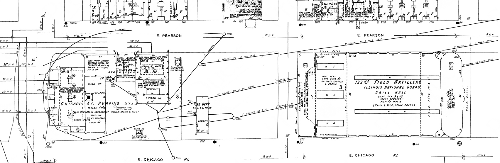 In this detail from the 1950 Sanborn Insurance Map, the Chicago Avenue Armory stands on the space that was clear until its east wing was built in 1915. While today's Museum of Contemporary Art's grounds utilize the entire armory footprint, by their building agreement, the museum only occupies half of the grounds. Because of the tunnel structure and the high water table, basements were not part of either buildings' design. The tunnels have been closed since the 1930s. |